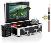
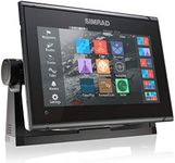
Buying Guide for the Best Chartplotters
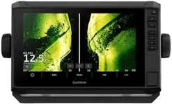
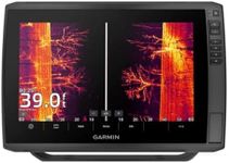
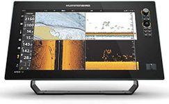
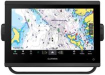
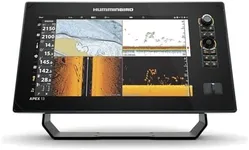
Choosing the right chartplotter for your boating needs can significantly enhance your navigation experience. A chartplotter is an essential tool that combines GPS technology with electronic charts to help you navigate waterways safely and efficiently. When selecting a chartplotter, it's important to consider several key specifications to ensure it meets your specific requirements. Here are the main specs to focus on and how to approach them.Screen SizeScreen size refers to the diagonal measurement of the display. This spec is important because it affects how easily you can view and interpret the information on the screen. Screen sizes typically range from 5 inches to 12 inches or more. Smaller screens are more compact and can be ideal for smaller boats or limited space, while larger screens provide better visibility and are easier to read, especially in rough conditions. Choose a screen size that fits your boat's layout and your personal preference for readability.
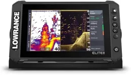
ResolutionResolution is the number of pixels on the screen, which determines the clarity and detail of the display. Higher resolution means sharper and more detailed images. Resolutions can vary from basic (480 x 800 pixels) to high-definition (1280 x 800 pixels or higher). If you need to see fine details on charts or want a clearer view of sonar images, opt for a higher resolution. For general navigation, a standard resolution may suffice.
GPS AccuracyGPS accuracy indicates how precisely the chartplotter can determine your location. This is crucial for safe navigation, especially in areas with narrow channels or obstacles. GPS accuracy is typically measured in meters, with more advanced models offering accuracy within a few meters. If you frequently navigate in challenging environments, higher GPS accuracy is beneficial. For casual boating, standard accuracy may be adequate.
Chart CompatibilityChart compatibility refers to the types of electronic charts the chartplotter can use. Different chartplotters support various chart formats like Navionics, C-MAP, or proprietary charts. This spec is important because it affects the detail and coverage of the maps you can access. Ensure the chartplotter is compatible with the charts you prefer or need for your boating area. If you travel to different regions, look for a model that supports multiple chart formats.
ConnectivityConnectivity options include Wi-Fi, Bluetooth, and NMEA 2000 compatibility. These features allow the chartplotter to connect with other devices and systems on your boat, such as radar, sonar, autopilot, and mobile devices. Connectivity is important for integrating your chartplotter into a comprehensive navigation system. If you want to share data between devices or control your chartplotter remotely, look for models with robust connectivity options.
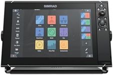
User InterfaceThe user interface encompasses the layout and ease of use of the chartplotter's controls and menus. A well-designed interface makes it easier to access and interpret navigation information. Interfaces can range from simple button controls to advanced touchscreens with customizable menus. Consider how comfortable you are with technology and choose a user interface that you find intuitive and easy to use. If you prefer simplicity, opt for basic controls; if you like advanced features, look for touchscreens with customizable options.
DurabilityDurability refers to the chartplotter's ability to withstand harsh marine conditions, including exposure to water, salt, and sunlight. This spec is important for ensuring the longevity and reliability of the device. Look for chartplotters with waterproof ratings (such as IPX7) and robust construction. If you boat in rough conditions or saltwater environments, prioritize models with high durability ratings. For calmer waters, standard durability may be sufficient.